Karnataka Revenue Map Overview: How to View and Download Village Land Maps Online
The Karnataka Revenue Map is an official land survey document that shows detailed boundaries, plot divisions, and land classifications of rural and urban properties. These maps help landowners, buyers, surveyors, and legal professionals verify property limits and ensure accurate land-related transactions.
In this guide, we explain how to view and download the Karnataka revenue map online using government portals like Bhoomi and SSLR (Survey Settlement and Land Records). To begin, let’s first understand what a Karnataka Revenue Map actually is.
What is a Karnataka Revenue Map?
A revenue map is a government-issued sketch or plan that outlines:
- Survey numbers and plot boundaries
- Land classification (agricultural, non-agricultural)
- Adjoining plots and village layouts
- Landmarks, nearby water bodies, and access roads (where applicable)
These maps are prepared and maintained by the SSLR department and are also accessible through the Bhoomi portal. Now that you know what a revenue map includes, let’s look at why it’s so important.
Why is the Revenue Map Important?
Revenue maps play a vital role in:
- Verifying land location and boundaries before purchase
- Resolving land disputes between neighbors or family members
- Applying for land use change approval, infrastructure development, or fencing permissions
- Conducting land surveys for legal or agricultural purposes
- Cross-verifying RTC (Record of Rights) data
For both rural and urban properties, a revenue map adds a visual representation of your land’s legal structure. If you’re ready to access a map for your property, follow the step-by-step guide below.
How to View Karnataka Revenue Map Online (Step-by-Step Guide)
Follow these steps to access the revenue map online:
- Visit the Bhoomi Karnataka Portal: https://landrecords.karnataka.gov.in/
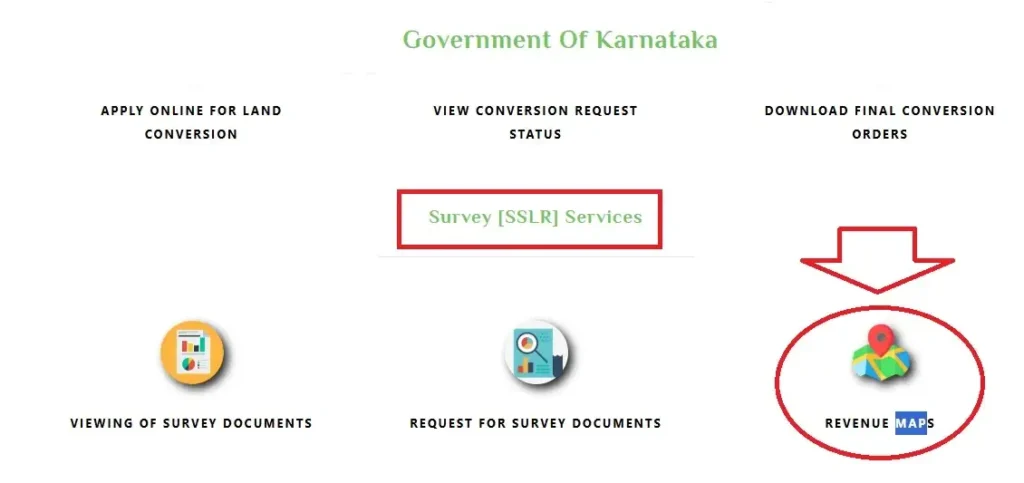
- Click on “View RTC & MR” or look for the SSLR services link.
- You may be redirected to the SSLR online system (https://dishaankarnataka.gov.in/ or landrecords.karnataka.gov.in).
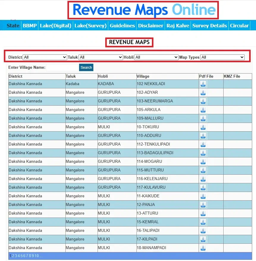
- Select your District, Taluk, Hobli, and Village.
- Enter your Survey Number or plot number.
- Click “View Map” or “Sketch” to see the land boundary layout.
Make sure to use updated browser settings and allow pop-ups if required. Once you have the map open, here’s how to download or print it if needed.
How to Download Revenue Map Karnataka (PDF or Print Format)
While not all maps are downloadable, you can follow these steps to download or print when available:
- After viewing the map, click on the “Print” or “Download” button (if shown).
- Save the map as PDF format or directly print the map.
- For official purposes, visit the Taluk Office or SSLR Department to get a certified copy.
If online download isn’t supported for your village, request the map manually at your nearest revenue office.
How to Find Revenue Map Using Survey Number
Revenue maps are generally organized based on individual survey numbers assigned to land parcels. Here’s how to search:
- Use the Survey Number Search Tool on the Bhoomi or SSLR portal.
- Enter accurate details for your district, taluk, hobli, village, and the corresponding survey number.
- If your survey number is available in the system, the associated section of the map will be displayed.
If you don’t know your survey number, refer to your RTC or property documents. Let’s now compare the different platforms available for viewing these maps.
Bhoomi vs SSLR: Where to Access Revenue Maps
| Portal | Access Type | Best For |
|---|---|---|
| Bhoomi Portal | View basic land records + map sketch | Landowners |
| SSLR Portal | Detailed maps, sketches, and GIS | Surveyors, legal users, developers |
| Dishaank App | GPS-based real-time land data | Field verification using mobile |
Using both portals together gives you complete land data: RTC + MR + Survey Sketch.
Common Issues While Accessing Revenue Maps Online
| Issue | Solution |
|---|---|
| Village or survey number not found | Check for spelling errors or select correct Taluk |
| Map not loading | Try using a desktop browser or clear cache |
| Survey details not matching | Cross-check RTC or contact local VA (Village Accountant) |
| Download option not available | Visit Taluk office for certified map |
Other Related Services on Bhoomi Portal
- RTC Online View: Check ownership and land use details
- Mutation Register (MR): View ownership change history
- Mutation Status Check: Track status of ownership change requests.
- Village Map Download: Access complete village boundary layouts with plot divisions
- Mojini V3 Login: Access Karnataka Land Survey Services Online
FAQs About Karnataka Revenue Map
Q1: Can I access Karnataka revenue maps online for my village?
Yes, most villages are digitized and available online, but a few may still need manual access through local offices.
Q2: Can I download revenue maps from the Bhoomi portal?
Some maps can be downloaded. For official certified maps, visit the revenue department.
Q3: How accurate are online revenue maps?
They are for reference. Final legal verification must be done through the SSLR department.
Q4: Is there a mobile app to view revenue maps in Karnataka?
Yes. The Dishaank mobile app, launched by SSLR Karnataka, allows GPS-based access to survey and land map data on mobile devices.
Conclusion
The Karnataka Revenue Map plays a crucial role in identifying legal land boundaries, confirming ownership, and classifying land types across the state. By accessing the map online through portals like Bhoomi or SSLR, citizens can save time and avoid unnecessary visits to government offices.
Whether you’re buying land, planning development, or just verifying ownership, revenue maps are a key part of your land documents.


