Bhulekh Odisha Map: Find Your Plot Location Using Bhu Naksha Online
Learn how to use Bhulekh Odisha Map to view land location, plot boundaries, and tehsil details online. Step-by-step guide using Bhu Naksha Odisha.
Quick Summary of Bhulekh Odisha Map
- Portal: bhunakshaodisha.nic.in
- Features: View plot, boundaries, area
- Search By: Plot number, Khatiyan number
- Downloadable Map: ✅ Yes
- Legal Validity: ❌ For reference only
Introduction
Bhulekh Odisha not only helps in checking land ownership records, but it also provides an easy way to view your land on a map. This is made possible through the integration of Bhu Naksha Odisha, a GIS-based system that visually displays plot boundaries, khatian details, and tehsil-wise land data.
In this article, you’ll learn how to use the Bhulekh Odisha Map feature to locate your land, check boundary lines, and download land maps.
What is Bhulekh Odisha Map?
Bhulekh Odisha Map is an online map-based tool that allows users to:
- View plot boundaries
- Identify nearby plots or landholders
- Get tehsil and village-level mapping info
- Download or print maps for official use
It uses data from the Revenue and Disaster Management Department, displayed using GIS (Geographic Information System) technology.
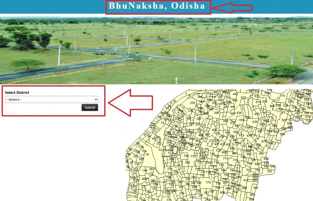
How to Access Bhulekh Odisha Map (Bhu Naksha)
Follow these steps to find your land location online:
✅ Step 1: Go to the Bhu Naksha Odisha Website
Visit http://bhunakshaodisha.nic.in
✅ Step 2: Select Your Location
Choose your:
- District
- Tahasil
- Village
- RI Circle
✅ Step 3: Enter Plot Details
Search by Plot Number or Khatiyan Number. The map will zoom into the plot.
✅ Step 4: View Plot Information
Click on the plot. A popup will show details like:
- Plot number
- Area
- Land type
- Owner name (if available)
✅ Step 5: Download or Print Map
You can print the map or save it as a PDF for documentation.
Features of Bhulekh OdishaMap
- 🗺️ Interactive village-level maps
- 📍 Plot boundary and number identification
- 📜 Link with ROR data
- 📤 Print/download options for offline use
- 📊 Data layers for land classification
Difference Between Bhulekh Odisha ROR and PlotMap
| Feature | ROR View | Bhulekh Map View |
|---|---|---|
| Shows Ownership | ✅ Yes | 🚫 Not always (map only) |
| Shows Plot Boundary | ❌ No | ✅ Yes |
| Used for Legal Docs | ✅ Certified ROR needed | ❌ Map is for reference only |
| Search By Plot No | ✅ Yes | ✅ Yes |
Benefits of Using Bhulekh Odisha Map
- 📍 Locate your exact plot visually
- 🧾 Supports better land dispute resolution
- 🧭 Useful in planning land development
- 📝 Good for layout design and mapping
FAQs
Q1. What is Bhulekh Odisha Map?
A: It is an online map tool that shows land plots using GIS-based mapping through Bhu Naksha Odisha.
Q2. Can I find my plot using the map?
A: Yes, you can enter your plot number or khatiyan number to find the land on the map.
Q3. Is the Bhulekh map available for all villages?
A: Most villages are covered, but in some cases, maps may still be under update.
Q4. Can I download or print my land map?
A: Yes, you can print or download the map as PDF for offline use.
Q5. Is Bhulekh OdishaMap legally valid?
A: It is for reference. For legal use, you still need the certified ROR from the Tahasil office.
Related Articles
- 🔗 Bhulekh Odisha Land Records: How to Check ROR, Khatiyan & Plot Details
- 🔗 Odisha Bhulekh ROR View: Step-by-Step Guide to Access Land Records Online
Conclusion
The Bhulekh Odisha Map feature through Bhu Naksha makes land location easy to understand by showing the plot’s position visually. It is especially useful for those involved in land buying, property layout planning, and dispute checking.
For full ownership details, always combine the map with the ROR view. You can access both tools from the official portal and keep your land-related information up to date.
